Compare sky coverage between metadected catalog an object catalog
This is a simple script to compare the sky coverage of the two different processings
Standard imports
[1]:
import tables_io
import matplotlib.pyplot as plt
Read the input data
[2]:
t = tables_io.read('test_data/object_10463.pq')
t2 = tables_io.read('test_data/shear_wmom_0p01_cleaned_10463_ns.pq')
column_list None
column_list None
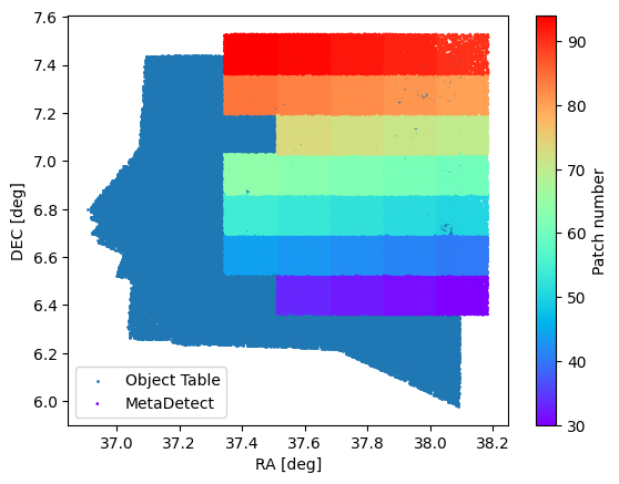
Plot the footprints of the object table and metedetect table
[3]:
_ = plt.scatter(t.ra, t.dec, s=1, label="Object Table")
_ = plt.scatter(t2.ra, t2.dec, s=1, c=(t2.patch_x + 10*t2.patch_y), cmap='rainbow', label="MetaDetect")
_ = plt.colorbar(label="Patch number")
_ = plt.xlabel("RA [deg]")
_ = plt.ylabel("DEC [deg]")
_ = plt.legend()
[ ]: